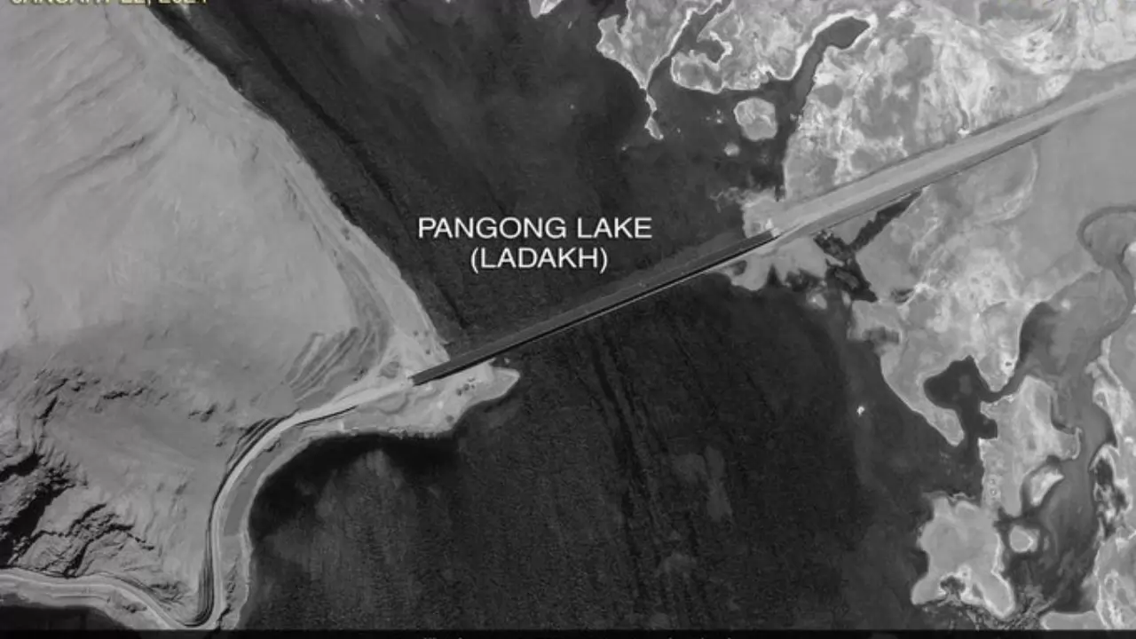
China completes 400-meter bridge (X/Frontalforce)
New Delhi: As tensions continued to simmer between the two countries, China has finished construction of a 400m bridge. Now new images show that the bridge has been black-topped and light motor vehicles are now crossing it. Located in territory controlled by China since 1958, near the Line of Actual Control between India and China in Ladakh, the bridge enables Chinese forces to rapidly move troops between the North and South banks of Pangong Lake.
Damien Symon, the satellite imagery expert and researcher with The Intel Lab said that the new bridge over Pangong Lake grants Chinese forces a direct, shorter route for rapid troop deployment. The People's Liberation Army had to navigate the lake's entire eastern section to reach conflict zones, a lengthy detour that hampered their response time in an active conflict zone.
Satellite Pics: Vehicles Cross China's Now-Complete Pangong Lake Bridge pic.twitter.com/SuovagbPw0
— Frontalforce 🇮🇳 (@FrontalForce) July 30, 2024
The bridge is expected to reduce the travel distance between the lake's banks by approximately 50-100 kilometers, significantly cutting travel time.
Satellite images also show road access linking the new bridge to the existing road network on the North bank of Pangong, which leads to Khurnak Fort, an ancient Tibetan structure seized by China in July 1958. A new road connects the bridge to Rutog, a Chinese garrison town and munitions hub.
After a series of intense confrontations along the Line of Actual Control (LAC) in Eastern Ladakh starting from May 2020, notably the Galwan Valley Clash resulting in the deaths of 20 Indian soldiers and reportedly four Chinese casualties, both nations reached an agreement. This agreement led to the establishment of a demilitarized zone surrounding Pangong Lake. As part of the agreement, China dismantled multiple structures situated between the strategic "Finger 4" and "Finger 8" points along the lake's shorelines.


Copyright © 2025 Top Indian News
